… Integrating Potentials
Be it subsalt interpretation in the Gulf of Mexico or UXO detection in the port of Hamburg, algorithm optimisation for a new software release or consulting services for a new gravity survey – no matter how intricate or complex, we find the right solutions for our clients.
How can we be of service for you?
From consulting in planning a survey to interpreting the final results – we are there for you. Our flexible inversion software can also handle data that goes beyond gravity, magnetics or EM. So, if you’re tired of trial and error, don’t hesitate to contact us.

Data & Acquisition
If you are planning a survey, we can help you to find the optimal survey parameters. We also provide rigorous QC procedures during and after acquisition. Using the data, we perform qualitative analysis applying filters, derivatives and other field transformations to improve the signal and increase insight. The information gained from these attributes can then be used, e.g. to find the most prospective locations. In many cases, we prefer to use modelling or inversion to determine the depth of sources, as it allows better control of any geological structures that deviate from the ideal scenario on which direct methods are based. In addition, inversion statistics help to understand the uncertainties of the results.
Processing
When processing gravity or magnetic data, we often use equivalent source techniques as they ensure the processed data is physically sound, reduce noise and create consistency, e.g. in gravity gradient processing. Equivalent sources also allow levelling, filtering, reduction to the pole (even at low inclinations) and other useful operations. The method represents the measured field as the effect of a source distribution that can be used for a forward calculation of the desired field, possibly a transformation of the input field. High frequency noise is automatically eliminated. Even if multiple components of the gravity or magnetic field have been measured, they must be represented by a single equivalent source distribution which also greatly reduces noise.


Interpretation
Interpretation requires well-prepared data in order to separate relevant information from non-geological content, e.g. topography effects, acquisition artefacts or cultural noise. Depending on the objectives and available data, interpretation can be based on qualitative analysis of gravity, magnetic or EM fields only, or can also involve quantitative modelling and inversion techniques.
Analysis
Data analysis is usually based on carefully processed Bouguer gravity, pole reduced magnetic or EM component fields. Different operators are applied to these attribute maps: Filters separate the wavelengths present in the field, while derivatives enhance medium to short wavelengths. Most curvatures and field transformations are based on tensor components and thus are free of long wavelengths. This processing combined with a careful choice of colour scales and shading can highlight interesting structures hidden in the original field, e.g. for the interpretation of lineaments.
Modelling
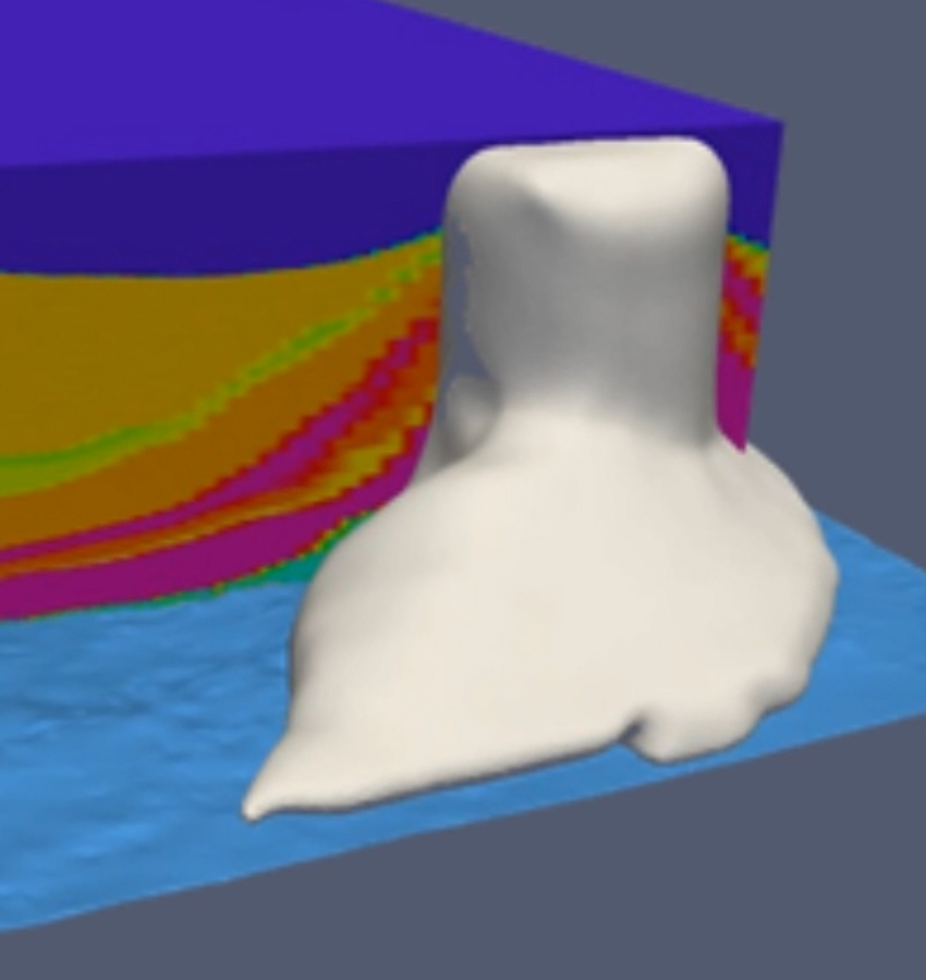
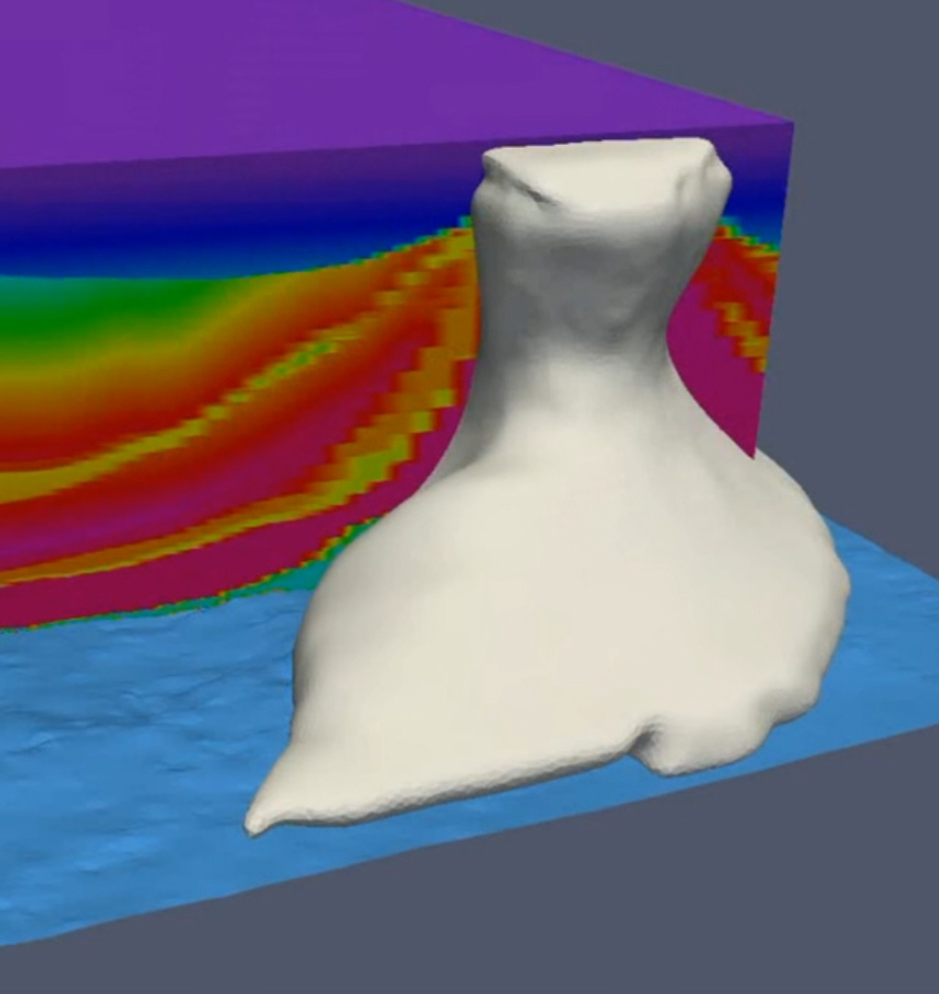
A 3D model by itself, created along with all available geological and geophysical information, can sometimes be an excellent (visual) consistency check, leading to model updates before gravity, magnetic, and/or EM modelling has even started. Our in-house software allows for both lateral and vertical density/susceptibility/resistivity gradients with various options to adapt distributions known from, e.g. seismic velocity models or borehole data. Model structures can consist of layered grids or geo-bodies which can be of arbitrary shape. 3D structural geometries can be manipulated directly from within the software during modelling; this is useful, e.g. if the flanks of a salt dome are uncertain or a fault location appears doubtful and should be modified according to the measured data. In most cases, such models are inverted in a second phase for the available (measured) parameter distributions and the specific geometries of the geological units.

Inversion
Inversion models are usually built from layered grids, faults and geo-bodies, defined by their triangulated surfaces, and from arbitrary parameter distributions (density, susceptibility, resistivity, velocity). Additional data is added via hard or soft boundary conditions (e.g. cross gradients) or can be subject to inversion itself in a joint inversion process. Our software is highly flexible, and even if the problem is exceptional, our unique JIF (Joint Inversion Framework) can usually be adapted to deal with it. We invert for all unknown parameters simultaneously so that the result is free of bias. The inversion statistics are examined to learn about parameter dependencies, reliabilities and resolutions. This leads to a better understanding of the model and, if necessary, to improved model definitions, e.g. refinements or simplifications, before a new inversion cycle is performed.
Interpretation & Evaluation
Interpretation usually takes place throughout the project in order to be able to implement new insights immediately. Therefore, regular exchange with the client is very important to us. At the end of a project, the latest interpretation is visualised in conjunction with a comprehensive evaluation of the results with respect to the defined project objectives and documented in the final report for reference.
Research
As TERRASYS’ approach is based on state-of-the-art technologies, R&D is an important aspect of our portfolio. Thus, we are constantly involved in research projects, such as SUGAR, Gitaro.JIM or FWIGREM, with international partners from industry and academia. A particular focus is on the development of our Joint Inversion Framework (JIF) for targeted, expert-distributed, multi-physics inversions based on structural geological models, as in the ongoing R&D project FWIGREM for a combined inversion of seismic waveforms (FWI), EM and gravity.

Consulting & Training
We have been working with non-seismic methods for over 30 years and are happy to share our know-how with you. If you would like to learn more about potential fields and their applications, we offer short courses tailored to your needs.
If you have any questions regarding these techniques, please do not hesitate to contact us. We offer consulting services ranging from issues before the survey is acquired to those long after the final evaluation.